In just 34 days (April 2) the 1940 census will be released. I have already signed up with FamilySearch.org to be an indexer. If you want to help too, you can get more information at the 1940 Census site: [link].
But what if you don’t want to wait for volunteers to build the name index? With a little effort and persistence there is apparently a way you may be able to find some of your relatives sooner. According to the National Archives site [link], NARA will be releasing the digital images indexed to the enumeration district level. I wanted to check into this to see how feasible it would be to locate some of my relatives using the this method.
Both my maternal and paternal grandparents lived in Pottstown, Montgomery County, Pennsylvania in 1940 and I have the exact street addresses. I wanted to see how easy (or hard) it is to find the enumeration district(s).
I started with the Steve Morse Unified 1940 Census ED Finder page [link]. I entered the state and county, but as it turns out, Pottstown was not one of the options on the city/town drop-down list. I had to chose other and enter Pottstown in the adjacent box. Clicking on the “Get 1940 ED numbers” box resulted in the screen below. The red box shows where I had to choose “Other” from the drop down box and then enter the town name. If the city I wanted had been available on the drop down menu, I could have entered the House Number and Street and pin pointed the ED. As it turns out, I got a list of all the ED’s in Pottstown.
In order to get more information about the EDs returned on the search screen displayed above, I clicked the 1940 ED Description radial button and the then the “More Details” button. The result is displayed below:
In reading through the ED descriptions, the boundaries are described in clock-wise rotation. I drew the red box around ED 173, which is the one containing both my paternal and maternal grandparents’ homes. You can get more information (such as the number of residences included in that ED) by clicking on the view button on the right.
The reason I was able to hone in on ED 173 is because I am familiar with the street layout in this area of Pottstown. It would, however, be easier to visualize the EDs if they were drawn on a map. So finding the map was my next step.
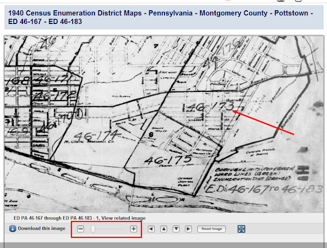
As it turns out, you can get an ED map display from the NARA 1940 census research site: [link]. Follow the instructions under bullet 3 on that page. It will advise you to go to the Online Public Access Page [link]. I entered “1940 census enumeration district maps pottstown pennsylvania” in the search box on the Online Public Access page, and got the following map:
By zooming in using the controls at the bottom of the map, it’s easy to confirm that ED 173 is indeed the one containing the addresses that I am interested in. So now, come April 2nd, I have the option of either waiting for the name index or browsing through the images of ED 173.


You did a great job of explaining this process. I went through it for a couple of families last summer at http://frommainetokentucky.blogspot.com/2011/08/tuesdays-tip-getting-ready-for-1940.html.
It’s fun to look at these old maps, especially when you’re familiar with the community.
Thanks Elizabeth! Looks like the Morse and the NARA finding tools have changed slightly since your posting, but the process is definitely very similar. It does seem that once you have a street address, finding the ED is fairly easy. I may look for a few relatives by browsing the EDs, but I think that for the most part, I’ll be waiting for the name index. :)
Pingback: Finding Enumeration Maps for Southeastern Pennsylvania Counties | Janis' Genealogy Blog